The first beautiful metro map in the history of St. Petersburg has been updated:
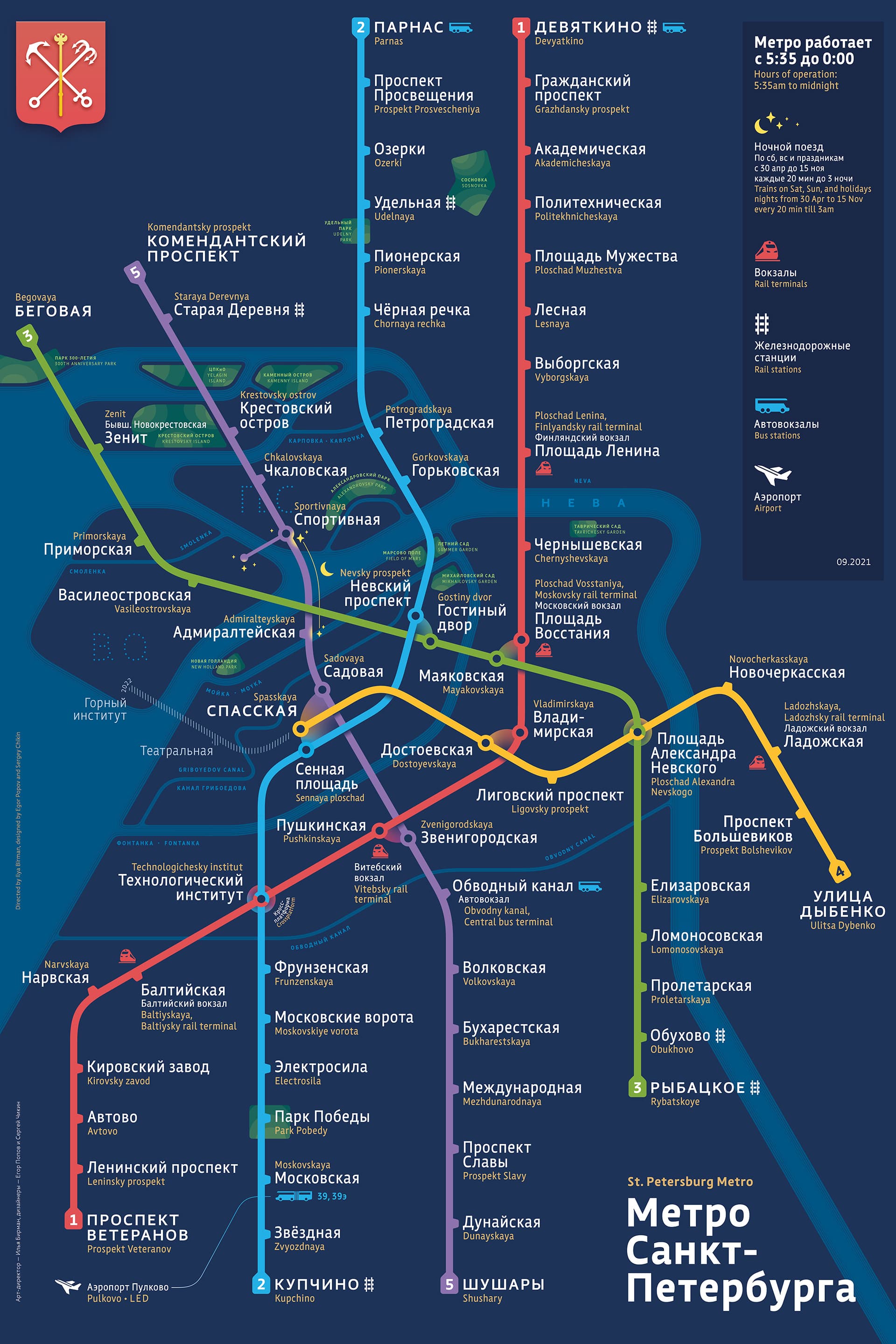
The new stations were added and a thousand of other changes were made: the colors, geometry of islands, and positions of the airport and some stations were updated, some parks were added.
The map is now available as a poster.
The calm version got similar update:
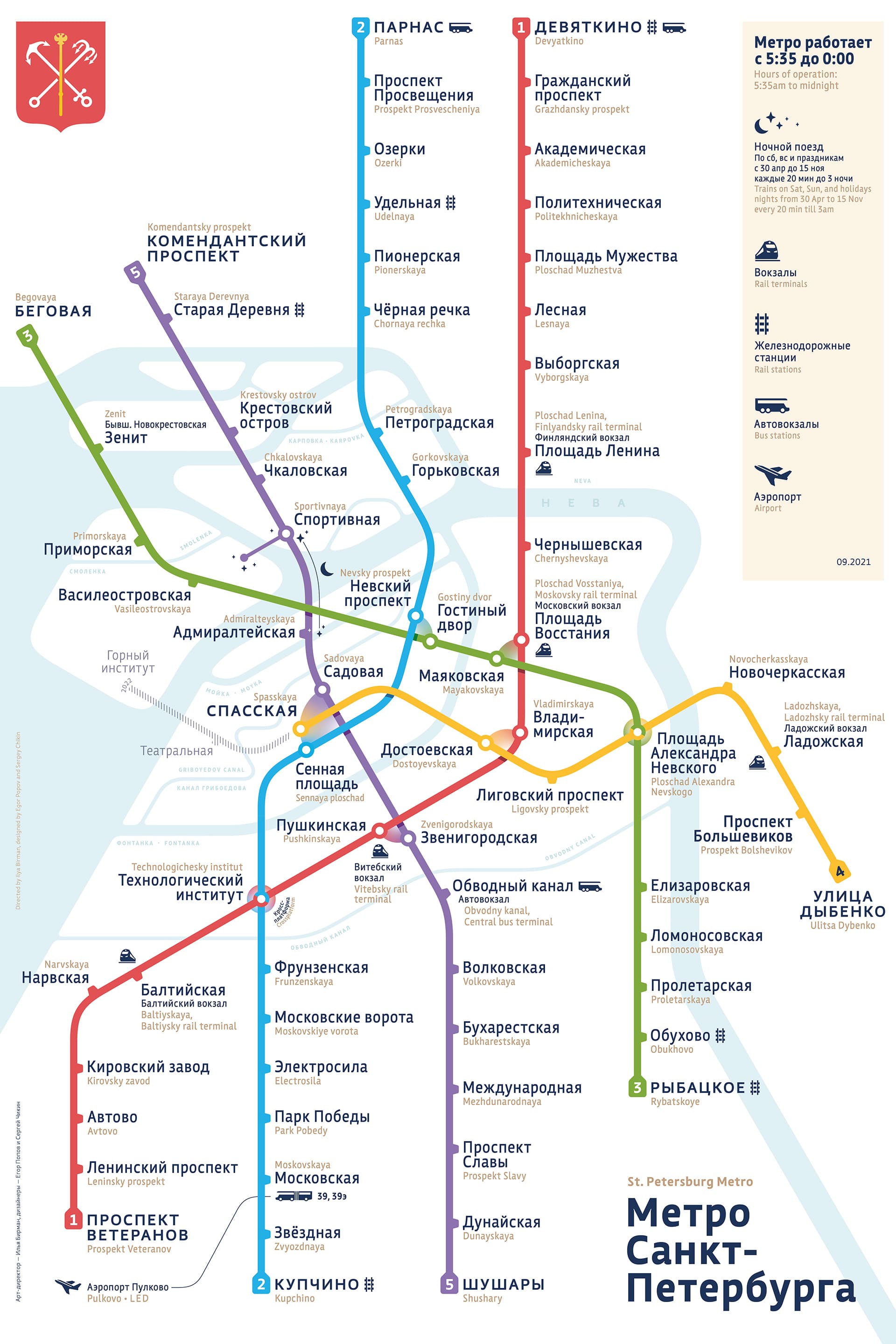
See the details on design of the previous version.
We still invite the St. Petersburg Metro authorities to adopt our map.
Tweet
Share
Share
Pin